Map
Map
Accessible by Public Transport: Stoke-on-Trent station is 0.3 miles away.
To provide you with the best experience, cookies are used on this site. Find out more here.


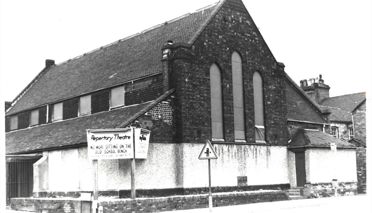
Stoke Repertory Theatre
In 1920 a group of young men and women from North Staffordshire launched the Stoke-on-Trent Dramatic Society with a production of Caste at the Empire Theatre, Longton. By 1923 they had changed the name of their group to The Repertory Players, the name by which it has been known ever since.
In 1932 the opportunity arose for the Players to rent St. Jude’s Parish Hall at the corner of Beresford Street and Victoria Road (now College Road) in Shelton. Within three months the hall was transformed into a performance space with around 200 seats. Sir Percival Heywood performed the official opening ceremony of the Stoke Repertory Theatre and the first production was ‘Lean Harvest’ by Ronald Jeans which opened on Monday 27th March 1933. The company continued to present shows in this building for the next 64 years until July 1997 when the Players moved to their brand new home on Leek Road.
The building is now home to the Makki Masjid Mosque.
Accessible by Public Transport: Stoke-on-Trent station is 0.3 miles away.
Whitfield Valley Local Nature Reserve covers a large area in Norton and Bradeley. The…
Described by Sir Nikolaus Pevsner as ‘the finest piece of Victorian axial planning in the…
Sculptor: Vincent Woropay. Originally commissioned for the National Garden Festival at…
Sculptor: Edward Davis. One of Stoke-on-Trent’s most famous son’s Josiah Wedgwood (1730 –…
Sculptor: Ondre Nowakowski. Visible to passengers travelling south as they depart…
Hanley Park is close to both the City Centre and the railway station. It is a fantastic…
Sculptor: Emily Campbell. Love Ties was created after the artist worked with local people…
This stainless steel relief extends along the northern and southern sides of the A500…
Learn about the history of the factory, see displays of fine ceramics and archival films;…
St Marks church was built in 1833 at a cost of £10,000. Designed by J. Oates, it is the…
Sculptor: community project. In May 2000, artists were commissioned to develop the images…
NOW RE-OPENED
Ninja Warrior UK Adventure sessions allow you to fully explore the park…
The roots of the city's ceramic prosperity are found in the Minster: Josiah Wedgwood is…
The Emma Bridgewater factory sits in a lovely position alongside the Caldon Canal lies in…
Discover how they put the 'bone' in bone china at the last working steam-powered potters…
Welcome to the Itinerary Planner. Use this tool to build your own journey or choose from an exciting range of specially selected tours.
To build your own Itinerary, click  to add an item to your Itinerary basket.
| Added...: | |
|---|---|
| Beresford Street | |
Copyright 2025 Visit Stoke. All Rights Reserved


We are now retrieving your search results. Please wait, this may take up to 30 seconds


Please wait, this may take up to 30 seconds
![]()
Supporting the Destination
![]()
Quality Guarantee
![]()
Secure Transactions
We are now retrieving real time availability results. Please wait, this may take up to 30 seconds.


